author: Aliya Ryan
date: 2017-03-28
slug:
title: "Mapping Waorani Territory: Update from the Ecuadorian Amazon"
wordpress_id:
categories: – blog
image: https://images.digital-democracy.org/assets/wao-nemopare-map-presentation-1600@2x.jpg
–
This post is from our newest team member, Aliya Ryan, who is recently back from working with our partners, the Waorani, in Ecuador, to create maps of their ancestral territory.
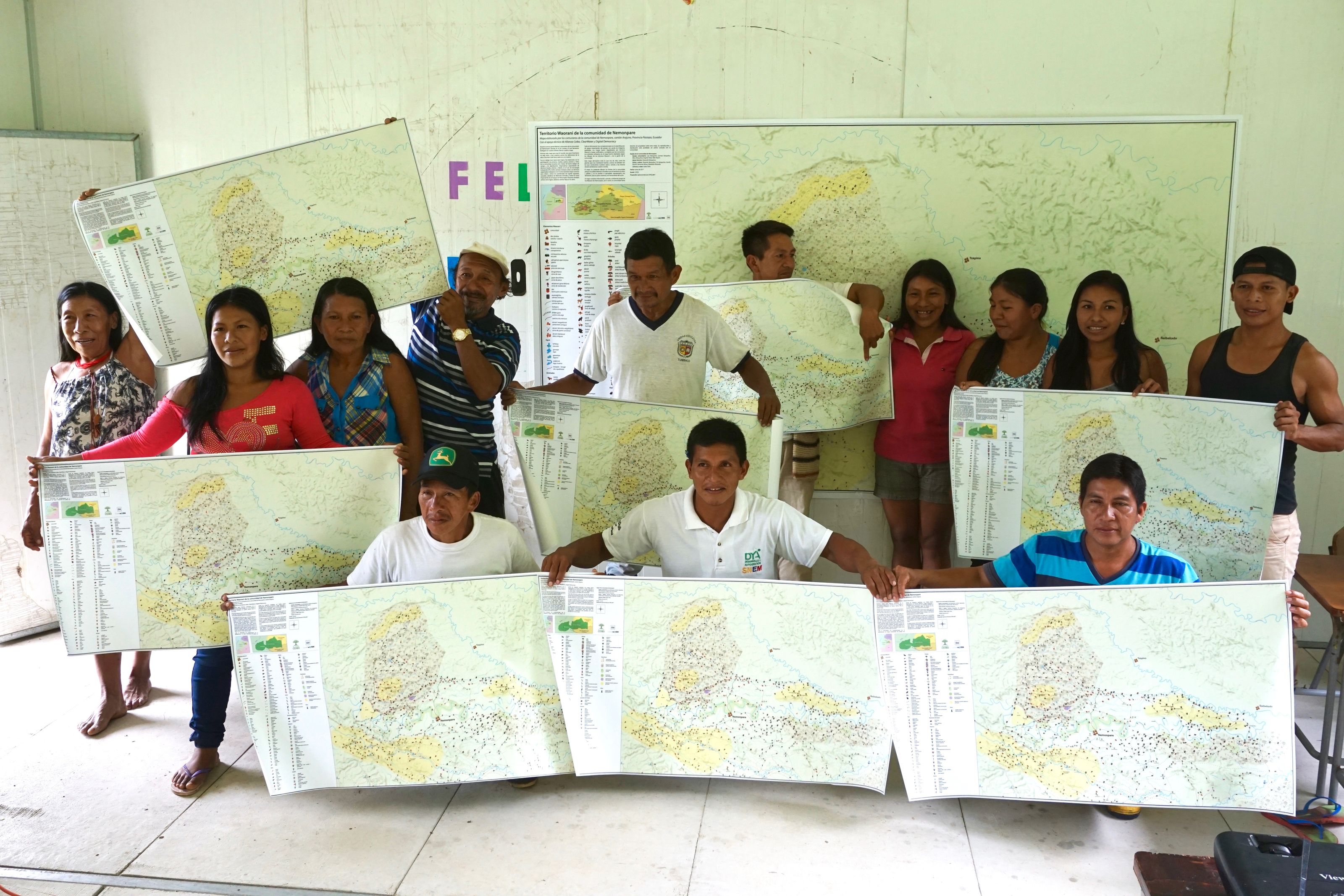
Last month I joined the Waorani territory mapping team in the Ecuadorian Amazon to present printed territory maps to the Waorani villages of Nemopare and Kiwaro. The maps are the culmination of a fourteen-month process that started with participatory mapping workshops in each village. They made dozens of walks through the territory with a GPS, and the Waorani themselves digitized the data in a new offline mapping application, Mapeo. Mapeo is being co-developed by Digital Democracy and our partners in Ecuador and Guyana to enable communities to create and manage their own digital maps.
The Waorani decided to start the mapping process after visiting indigenous territories in Northern Ecuador suffering the impacts of decades of oil extraction. Many Waorani communities still have intact, healthy lands and forests, rich in hunting, fishing and other resources. However, the Ecuadorian Government has recently opened up the whole of the Amazon for seismic testing, and some Waorani are concerned that their lands will suffer the devastating environmental and social impacts of oil exploitation, or other extractive and unsustainable practices including mining and industrial agriculture.
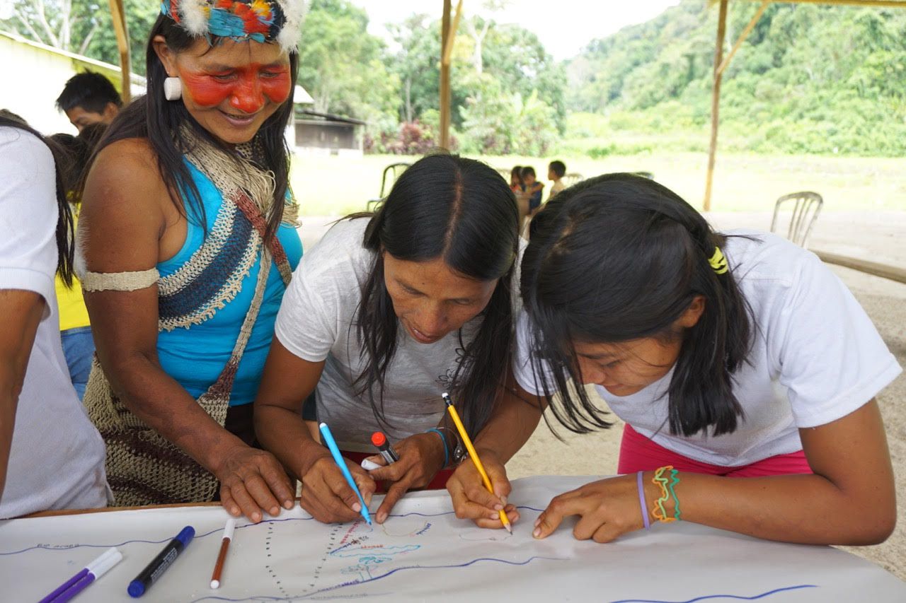
The communities worked alongside Alianza Ceibo, an umbrella coordinating group made up of representatives from four Ecuadorian indigenous peoples, ClearWater, a support organization, and Digital Democracy. In an initial meeting members of the village drew maps of their community lands, marking rivers and streams, hunting and fishing grounds and areas containing important resources. This was followed by walks in which village members accompanied a technical team of four Waorani, trained in GIS and GPS, to visit important areas, track hunting and other paths and collect GPS points to help digitize the hand-drawn maps.
The Waorani technical team — working offline, in the villages, and alongside the village mapping teams — entered the data from the GPS and hand-drawn maps into Mapeo (read more about how Mapeo works). Mapeo is built upon the easy-to-use open-source editor that powers OpenStreetMap, with customizations to use presets and icons reflecting the sites and resources the Waorani wanted to mark, such as animal tracks, waterfalls, medicinal plants and areas of palms used for crafts.
Initial draft maps were printed and then checked and revised in each village before the final maps were prepared in Mapbox Studio, using text and symbols designed by the Waorani. Each family in Nemopare and Kiwaro received a 3ft x 2ft copy and a larger 9ft x 5ft version was printed for communal use.
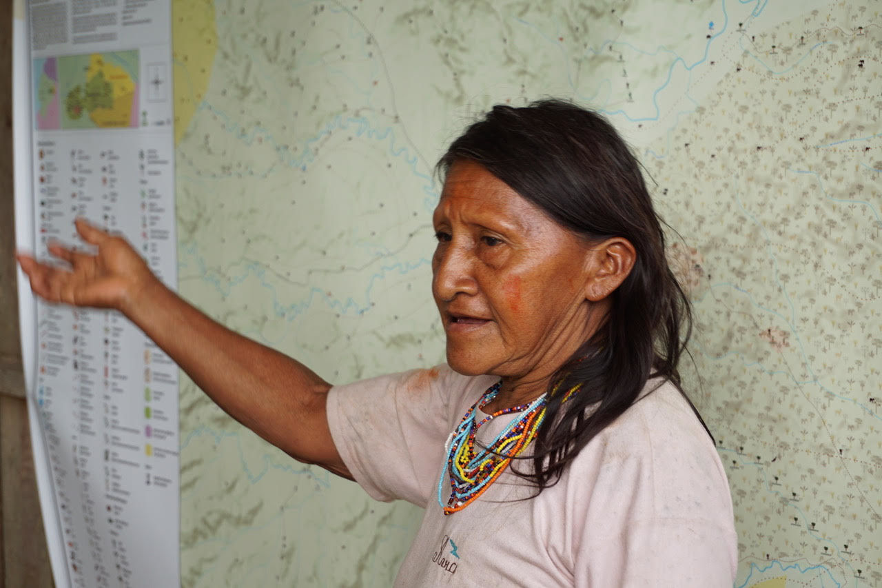
Although from one point of view presentation of the maps marked the end of a process, for the community it represents a new way of thinking about and ordering land and resources; the meeting provoked a long discussion between village members. One man said that it would support him and other pikenani (elders) to transmit their knowledge of customary rules regarding relationships with the forest to younger generations and one of the village technicians reflected on how they could use the map to prepare for inevitable encounters with oil company and government representatives, and better defend their land from unwanted impacts.
For the rest of the team these maps also represent a first step. There are over fifty Waorani communities that hope to take part in the mapping process over the next few years, creating maps for each village’s internal processes and combining to produce a map of the whole of Waorani territory.
The technical side also has some way to go, to stabilize and build greater functionality into Mapeo, to test it for diverse use-cases and to create compatible tools and data management systems. Its potential is to simplify and democratize the process of mapping for indigenous and other marginalized communities worldwide and to support campaigns upholding human and environmental rights.
If you are interested in the technical workings of Mapeo, all our development is happening in the open on GitHub where you can follow along and, if you have time and the skills, jump into the issues and help us fix some things.