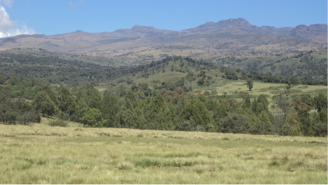
The Ogiek of Mount Elgon are an Indigenous group native to Western Kenya. As Indigenous hunter-gatherers, the Ogiek are considered to be the original inhabitants of Kenya’s highland areas, and prior to colonization occupied a wide area in that country and across national borders.
Since the beginning of the twentieth century, huge areas of Ogiek lands have been lost to “conservation areas” and agriculture zones imposed by the colonial government. The neighboring communities then started encroaching on the forests that the Ogiek community had been evicted from. All these actions exclude the traditional Indigenous custodians and consistently fail to protect the wildlife or the environment. Ogiek lands are badly impacted by ongoing encroachment, habitat conversion and poaching especially because the community has lost the legal rights to protect their lands starting from the colonial times.
Today, the Ogiek of Mt. Elgon reside in a small part of their ancestral lands due to these evictions over the years. At Mount Elgon, the Chepkitale Native Reserve represents only one-tenth of the original extent of their territory, and their land rights are not fully recognized. The loss of their ancestral lands has endangered the survival of Ogiek culture, and continued encroachment leaves thousands of Ogiek with no place to go.
To counter this loss of territory, the Ogiek are taking action to advocate for their land rights and protect their ancestral forests. The Chepkitale Indigenous Peoples Development Project (CIPDP) was founded by the community with the mission of undertaking a rights-based approach to forest conservation. According to Peter Kitelo, the director of CIPDP,
“We look at forest as you look at a human being. Like it’s just there. It’s a friend, who doesn’t do anything bad to you. Why should anyone come and take it away from us? If you cut trees the landscape is not beautiful any more. You know the difference when you see it, and you realize that destroying forest is wrong. We don’t differentiate the different parts of our environment; it’s all part of our ecosystem and life. If everything’s not there, life is not complete.” (source)
The protection of Ogiek lands is a complex issue. According to the Kenya Community Lands Act of 2016, the Ogiek community ought to be involved in local level decision-making and national dialogues around community lands. The law also created an opportunity for communities to register for land rights secured in the new Constitution. However, in practice, the Ogiek community continues to be marginalized by more dominant local elites. Despite having time-tested methods for natural resources management, and being nominally included in some regional meetings, to date their voices have not been heard and their practices have not been respected by authorities and decision makers.
One powerful tool for increasing the ability of communities to advocate and communicate their views with external parties is mapping. Throughout our history supporting Indigenous peoples in the Amazon, the team at Digital Democracy has seen that participatory mapping can be one of the most effective ways for communities to advocate for their rights. We co-created the software Mapeo with our Indigenous partners to enable them to map their territories and collect evidence about degradation or environmental abuses, while retaining full control over the data and able to conduct this work entirely offline. Hence, when the CIPDP and our partners Forest Peoples Programme (FPP) approached us about helping the Ogiek shift the local power dynamics by using Mapeo to map and monitor their ancestral lands, we were eager to be involved, and also learn how we can best adapt Mapeo to the use case of an Indigenous community in another continent.
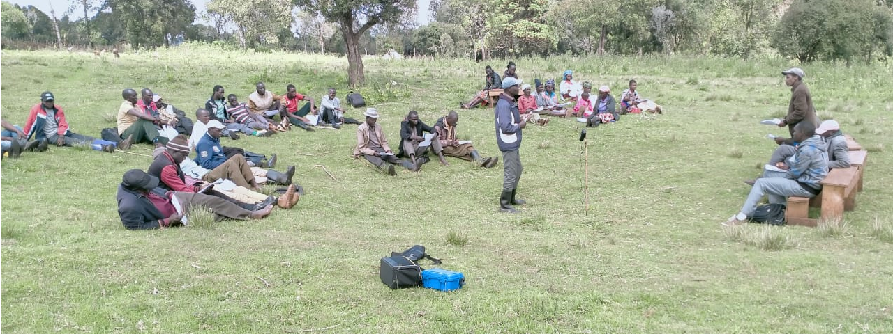
Sponsored by VOICE, our three organizations went to work on a project titled Boititap Korenyo, which means “The Wealth of our Lands” in the Ogiek language. The goal of the project is to enable the Ogiek to combine their immense knowledge and skills in managing their customary land with new community-based GIS technologies that will enable them to collect and leverage data describing land and resource use in order to defend and advance their land rights. Our team would proceed with several inception workshops at the community, introducing the project, training the community trainers, and launching a participatory process focused on mapping the ancestral lands at Mount Elgon.
As fate would have it, the project kicked off in the midst of the Covid-19 pandemic, and our team was forced into the now-ubiquitous reality of meeting remotely and encountering each other in the familiar grid boxes of video conferencing software. After several setbacks in trying to make travel arrangements happen during the pandemic, we course-corrected and opted to conduct most of our work, and even Mapeo training remotely, over Skype, with the local CIPDP mapping team at times able to travel to the villages to receive information. In this way, we worked to devise a bespoke Mapeo configuration for the Ogiek, with local mapping categories relevant to the Ogiek perception of their lands, and written in the native language. Following that, we planned trainings in Mapeo for the CIPDP mapping team, so that they would be able to impart that knowledge onto others in the community.
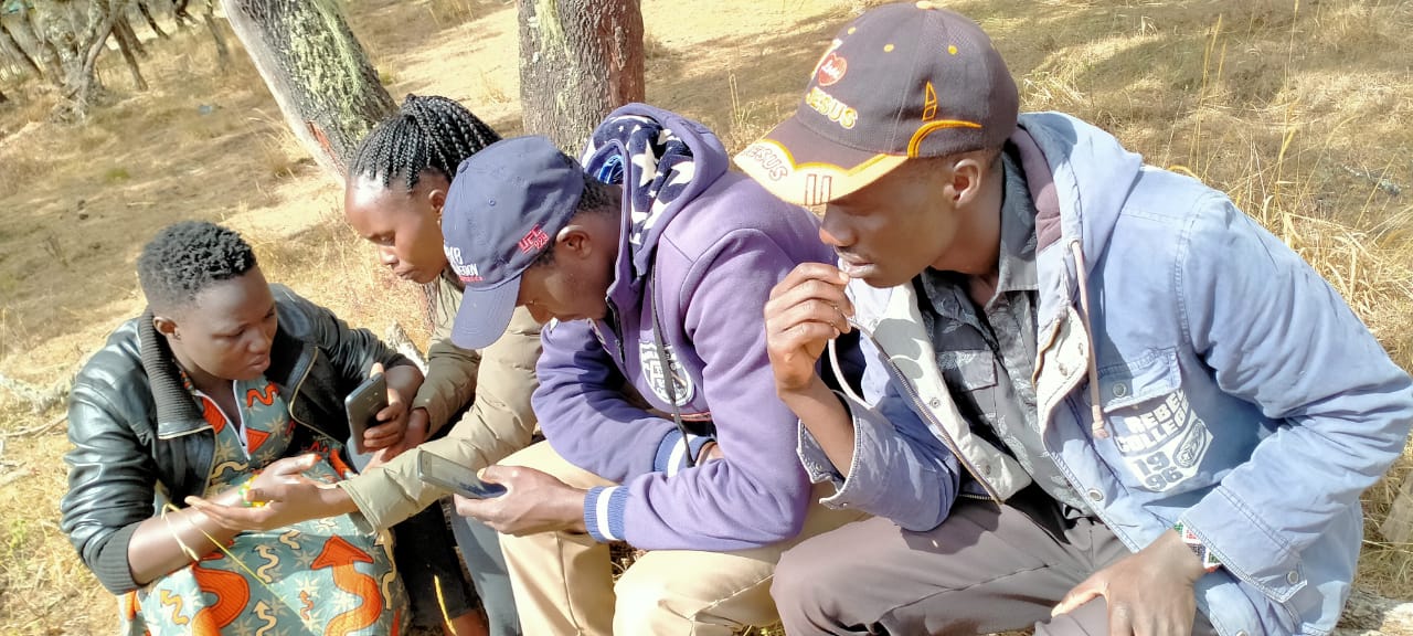
Although the remote format will never replace the full dynamism of an in-person training, the CIPDP mapping team was motivated and excited to learn, and over several training sessions the team felt confident in their ability to share how Mapeo works with the rest of the Ogiek community. After the training, one of the mappers noted:
“Today as we were starting this training, I was so green, I just downloaded it, I had no idea what it was, but the session was so interactive. We could even go and capture points outside, and use the Ogiek configuration that we made, so at least we can do it very practical, and it was an interactive workshop, so I’m happy, and knowledgeable.”
Following these remote training sessions, the CIPDP mapping team were able to travel to the Ogiek villages at Mount Elgon, and finally share their mapping knowledge with the broader community. The introduction of Mapeo coincides with a broader ongoing spatial planning process that the Ogiek are conducting, and the technology was very well received by participants who immediately perceived the value of this tool for their activities and needs. According to one community member,
“This software can make a big impact on the community’s struggles. Most of the time we’ve been having challenges (in) how we can store our findings that we can use as evidence. Sometimes, outsiders would come into the community lands, and we did not have access to data to show them what it looks like. But at the moment now using the tech of Mapeo we can have it, and put it in an archive that can be used later.”
As this participatory mapping process kicks off and will take place in the coming year and a half, we look forward to supporting and accompanying CIPDP and the Ogiek at Mount Elgon, and to learn from them how we can better create tools such as Mapeo to help increase community autonomy, and reduce dependency on outside help, in their struggle for their lands and rights.