Western common sense has most of us believing that the Amazon is a pristine paradise, untouched by human hands for thousands of years.
But even Western knowledge is catching up to the truth that the Amazon hasn’t been untouched for at least 10,000 years, and was actually much more inhabited in the past than it is today. As many as 20 million people lived in the Amazon in pre-Columbian times, which is far more than today. So we can’t blame “humans” for the destruction of the Amazon, as Indigenous peoples have been helping generate biodiversity and expand the forest for thousands of years and today, despite having been reduced to less than 5% of the world’s population, Indigenous people protect 80% of global biodiversity.
Mapeo has been successfully used in many cases as a tool for defending the rights and territories of Indigenous peoples, and consequently forests around the globe. In this post we’ll explore agroforestry through my experiences around my house and some larger scale projects around Brazil. This personal journey got me thinking how digital technology can assist reforesting projects, and how Mapeo can be a great fit.
Let’s start by digging into how different cultures occupy the land.
Where did our forests go?
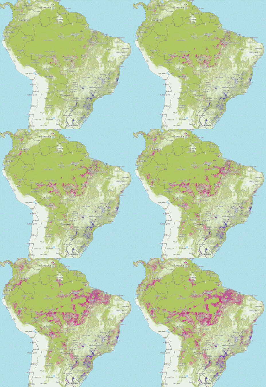
Invaders arrived on the south-eastern coast of Pindo Abya Ayala about 500 years ago and soon started extracting timber from its forests. In memory of the trees, invaders started calling that land “brazil”. Today over 93 percent of forests belonging to the biome around that coast, which came to be called Mata-Atlântica, is gone. And the forests in the Amazon are the next frontier.
Deforestation is not a “human” problem, but a cultural problem. It is estimated that 80% of Amazon rainforest deforestation is done to provide land for cattle ranching, which is purely in the name of greed justified by sustaining clearly unsustainable ways of life. At this point, it seems like we either learn from the Native Amazonians about how to support complex societies without destroying the environment or continue working to create apocalypse-like environments for future generations.
Before invasion, native cultures didn’t need monoculture or cattle raising to thrive. How were so many people fed within a forest environment? Researchers offer some insight on subsistence strategies used back then to maintain large populations:
“We found an abrupt enrichment of edible plant species in fossil lake and terrestrial records associated with pre-Columbian occupation. Our results demonstrate that, through closed-canopy forest enrichment, limited clearing for crop cultivation and low-severity fire management, long-term food security was attained despite climate and social changes. Our results suggest that, in the eastern Amazon, the subsistence basis for the development of complex societies began ~4,500 years ago with the adoption of polyculture agroforestry, combining the cultivation of multiple annual crops with the progressive enrichment of edible forest species and the exploitation of aquatic resources. This subsistence strategy intensified with the later development of Amazonian dark earths, enabling the expansion of maize cultivation to the Belterra Plateau, providing a food production system that sustained growing human populations in the eastern Amazon”
The legacy of 4,500 years of polyculture agroforestry in the eastern Amazon – Nature
How a society obtains its food supply is one of its most important cultural drivers. Our Western colonial societies certainly have their political and economical roots in how they have developed agriculture:
“Given a choice between patterns of subsistence that are relatively unfavorable to the cultivator but which yield a greater return in manpower or grain to the state and those patterns that benefit the cultivator but deprive the state, the ruler will choose the former every time. The ruler, then, maximizes the state-accessible product, if necessary, at the expense of the overall wealth of the realm and its subjects… The cultivation of a single staple grain was, in itself, an important step in legibility and, hence, appropriation. Monoculture fosters uniformity at many different levels… For the maker of a cadastral survey, a tax map, the situation was nearly ideal. Most land values could be calibrated to a single metric; each harvest both was compressed in time and involved a single commodity;”
The Art of Not Being Governed
So there’s a historical clue to why the Native Amazonians were building soil and cultivating forests while state societies were cutting them down to create green deserts. By putting our faith in states alone, we could very well be following a herd off of a cliff. In the past decades, regenerative agriculture movements–most notably permaculture–have gained popularity as alternatives to monocultural practices.
Since the 1960’s, Swiss agronomer, Ernst Götsch, has been doing his experiments in Europe, then learning from natives in Costa Rica and in the 80’s bought land and settled in the Brazilian state of Bahia. The land he bought was deeply desertified, and was called “Escapees from the Dry Lands”. Today it is known as “Water Springs Ranch” as a consequence of the collaboration between the Götsch family and locals in producing economically efficient crops while regenerating diversity and soil.
Ernst Götsch has been an important contributor to agroforestry, but he is not alone. Over the past decades agroforestry has become a movement and gained traction. These agricultural techniques have been widely researched and reproduced at different scales. In Brazil they’ve become more popular than permaculture itself and are a standard for regenerative farming practices–even for government projects.
The goals of agroforestry and syntropic agriculture are similar to those of the Native Amazonians–to build soil and foster native diversity while achieving nutritional, economical, medicinal and other culturally important yields.
The fundamentals are about understanding the cycles and needs of different species and especially the relations between them, so that instead of using pesticides or any external nutrients and minerals, different plants play their role in achieving balance. Soil life returns as it becomes more and more forest-like and with it fertility. Since there are many species, each better adapted to certain micro-climates, there are many different possibilities of relations yielding different results.
Home scale forest
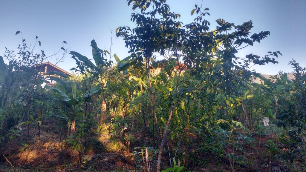
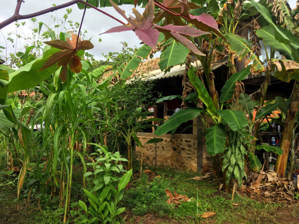
In practice an agroforest can have as many shapes as there are plants on the planet and depends greatly on each biome and available resources. As an example I’ll share the short experience we’ve had in regenerating the land cover around our own house, which had been previously deforested and occupied by cattle.
Professionally, I contribute as a developer with Digital Democracy and Coolab, so I don’t dedicate my life to planting and don’t depend on my harvests for survival. Before being granted access to cultivate this soil, I spent years helping out neighbors with their gardens and roças to learn about plants and soil, gain experience with the tools and harden the calluses on my hands. I’d had almost no prior experience and small amounts of dedication time to agroforestry. Most decisions were made based on intuition and not actual research.
This small piece of land has 2 rivers that meet at a corner, and has been used for cattle raising for at least the last 50 years. When I arrived there was a 5 meter area, from each river bank, that had some riparian forest, and an additional 5 meters of bushy vegetation that had grown in the past few years. The rest of the land was leftover pasture, and the plan was to turn it to forest.

The soil close to the riverbanks is really sandy, and having had cattle step on it for decades has made it very compact. When we started, we made a decision to not use any motor tools, so everything was done by hand with machetes and hoes.
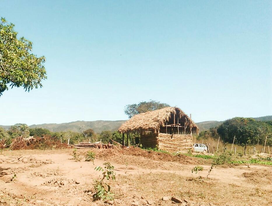
Because of my experience with traditional gardening, I was eager to start producing and there was an abundance of sunlight everywhere. The soil was really poor, so we added lots of chicken and cow manure and mulch, producing lots of vegetables during the first year and a half. From the start we also added lots of Jatobá (Hymenaea courbaril), which will make up the forest’s upper canopy when its climax is reached decades from now. The Jatobá fruit is very delicious and nutritious, and the timber is redwood quality.
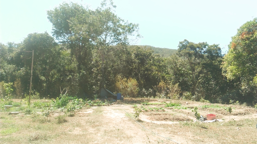
July 2017 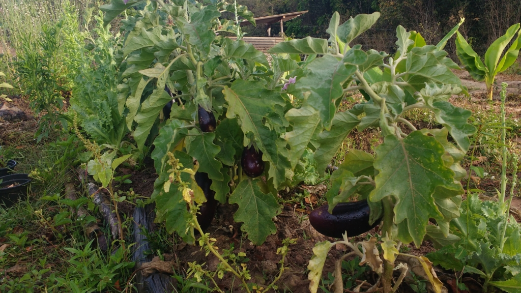
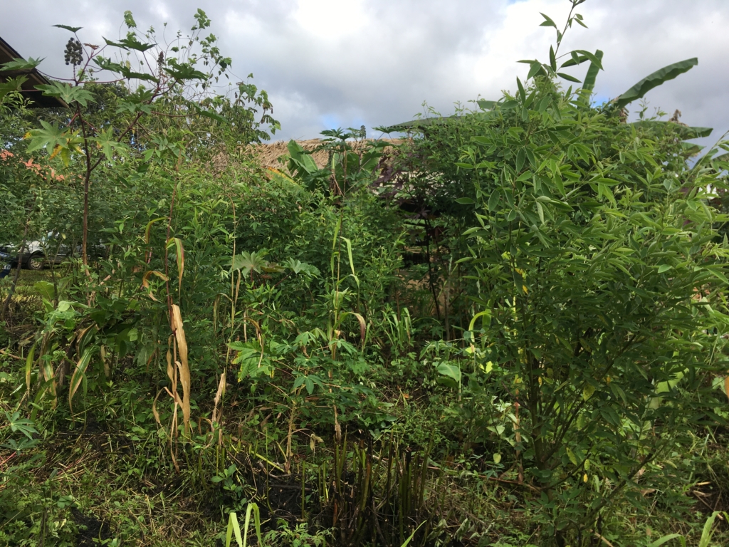
September 2017 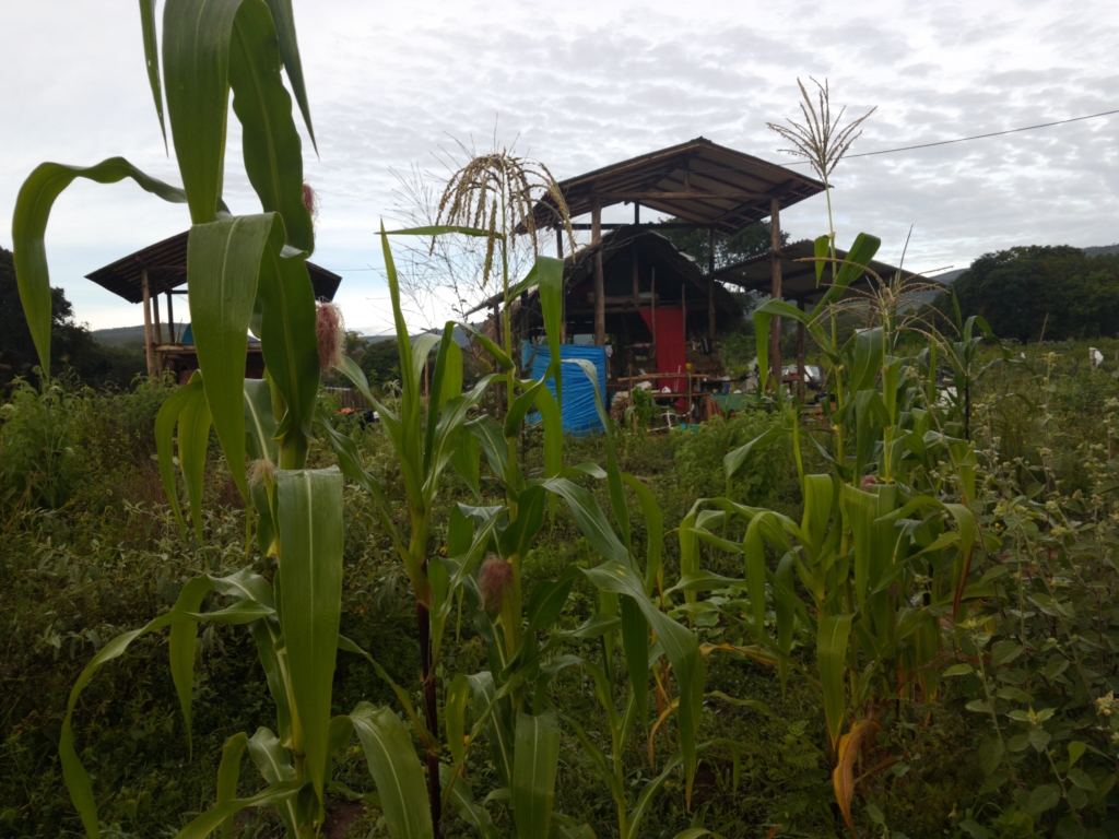
January 2018 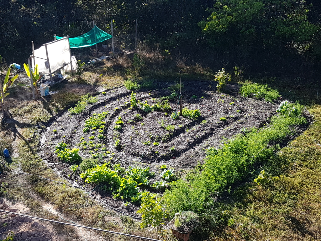
July 2018
We had spread fruit trees around the whole area, but it was only after a couple of years that we realised how important it was to produce more mulch and biomass, shifting priority from cultivating plants to cultivating the soil.
We started better aligning with the principles of agroforestry: exploring plant relations, their natural successions, stratification, planting in higher densities and pruning as much as possible.
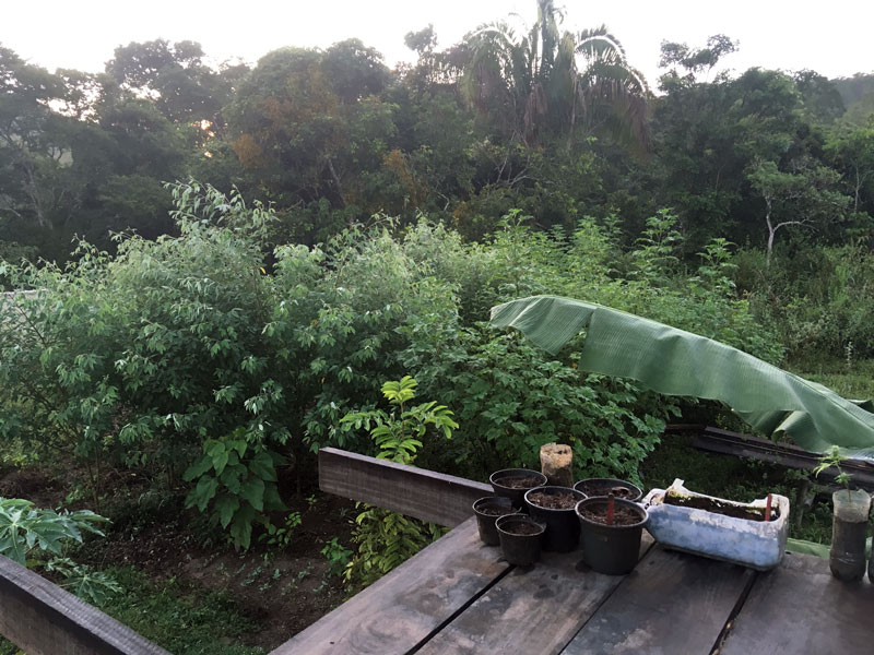
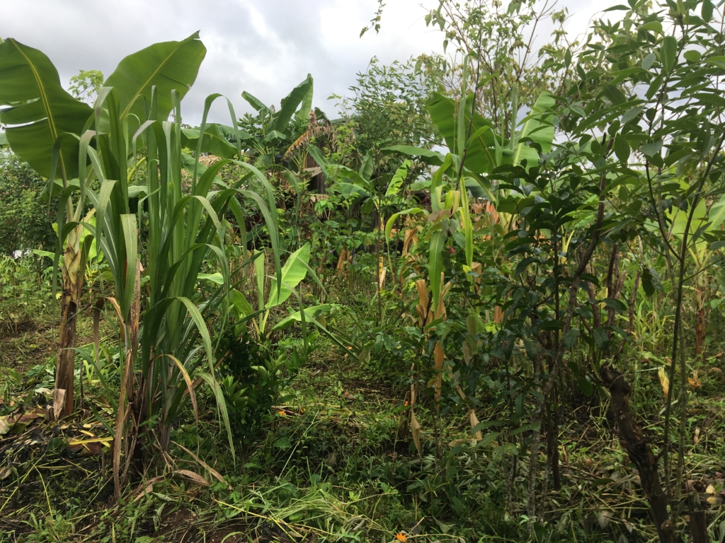
Guandu beans to help build soil fertility – 2019 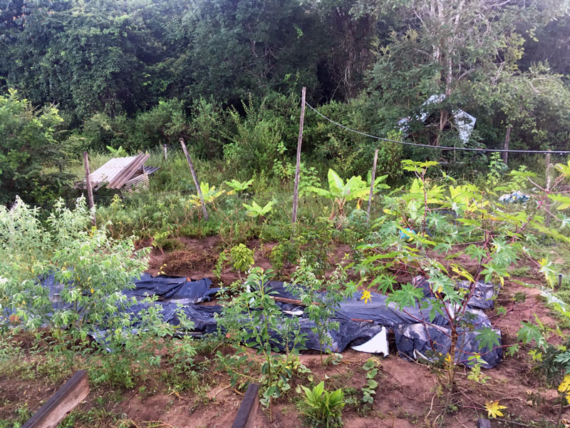
Exploring diversified stratum – 2019
We allied with medium cycle species that would help us accumulate energy, in the form of photosynthesis, such as the Guandu beans (Cajanus cajan) for fixing nitrogen and providing mulch and biomass; castor beans (Ricinus communis) for providing potassium and mulch; mulberries (Morus nigra), which provide lots of pruning material; and mexican sunflower (Tithonia diversifolia), which plays a major role in providing the large and constant amount of biomass that the soil needs.
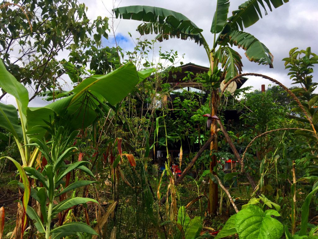
Two years later, our initial agroforestry systems (SAF) are slowly shifting from an accumulative type of system towards abundance. External manure and mulch are much less needed; the soil is full of life, leaf litter and becoming darker; there aren’t bursts of insects or diseases; and every year we come closer to producing enough to feed large animals (such as ourselves).
These days we’re constantly harvesting papayas, corn, squash, beans, bananas, plantains, cassava, guavas (planted by the birds), passion fruits, mulberries, several seasonings, herbal medicines, and much much more. And that’s not even the best part.
There’s always some pruning, planting or harvesting that needs to be done. In syntropic systems 5% is planting and harvesting, and 95% is pruning. Between computer work, agroforestry is our therapy. It’s a joyful part of our day where we get to collaborate and learn from a system that’s close to perfect, after over a billion years of evolution. It’s quite reassuring when compared to the clearly fragile human systems we have to deal with daily.
We still have loads to learn as our systems are far from optimal, but it’s amazing how conscious (and instinctive) little tweaks can greatly influence such complex systems. We’re still slowly expanding the cultivated areas, and there are still a few square meters to start working on. These 600 square meters have been a great personal proof-of-concept of the possibilities of this incredible life-producing, carbon-digesting technology.
Scaling the practice
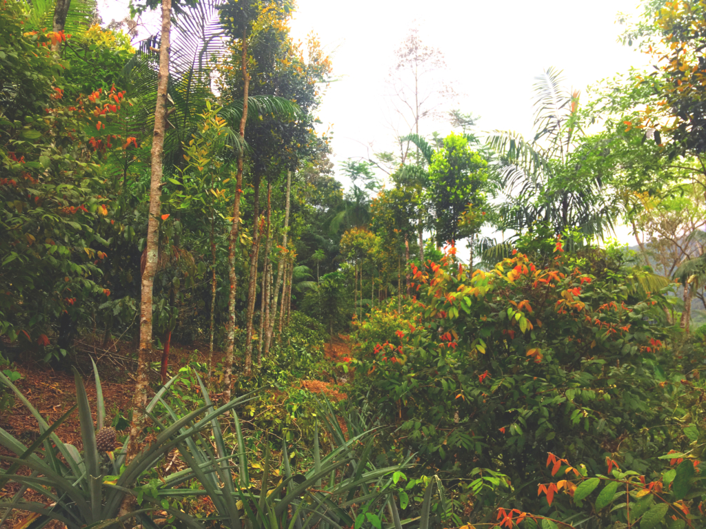
My home agroforest system is cute, but to actually see the full potential of this technology we visited Zé Ferreira, an experienced farmer living completely off-grid in the mountains of Parati, state of Rio de Janeiro. He’s been developing agroforestry systems for over two decades and his land is a great example of the abundance and diversity that can be generated. The most incredible part, which differentiates Zé’s farm from many others in Brazil, is the fact that he uses no hired hands and maintains several systems mostly by himself and guarantees all his income from processing and commercializing what he cultivates.
In the Amazon, coffee producers have successfully adopted agroforestry, which has prevented cattle pastures from taking over old coffee plantations, as well as doubled productivity in the region.
Adoption and adaptation of motor tools have been used to scale the creation and maintenance of agroforestry systems for large areas. Great examples are the adaptation of chainsaws for managing bananas and the tractor implement made specifically for agroforestry.
Similar to how agroforestry techniques and appropriate tools accelerate the natural cycles of biomes, communication and information tools can accelerate data collection, exchange and accessibility.
In syntropic systems efficiency is measured through photosynthesis:

Oxygen and sugar are what complex life forms need in abundance and carbon dioxide (which we generate) in excess is the main cause of climate-change, which might eventually exterminate most complex life forms if the anthropocene continues playing out at current speed. Forests not only generate abundance for large animals but can also save us from our self-causing doom. Why aren’t they the law?
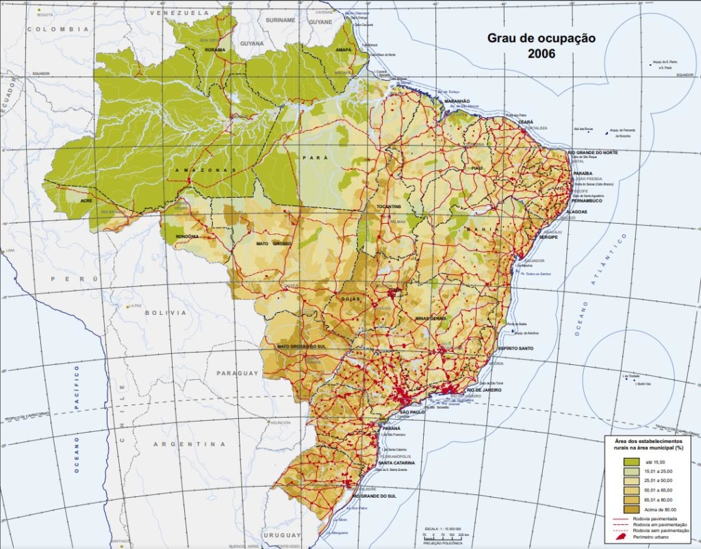
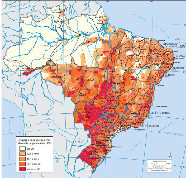
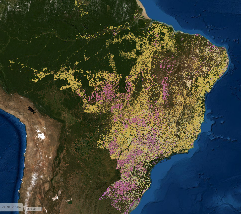
Maps are amazing tools for displaying territorial data. The maps above show us that in Brazil, 30% of the territory’s 851 million hectares has been deforested for monoculture crops, mainly cattle raising. That’s over 255 million hectares, of which 155 are pasture, 55 are monoculture, and 45 are a mix of those. All this land is very low on entropy, and truth be said, very economically unproductive, besides leaving an immense social and ecological footprint.
If we seek to effectively reverse deforestation, we need to scale knowledge sharing around the efficiency and potential of agroforestry. Lowering the barrier to entry to agroforestry tools and techniques is a way of achieving that. But as we’ve seen through our brief journey, there are many variables that need to be taken into account about each species and the relations they have with each other and the biome. It can take years of experience and research to really understand these relations.
As a developer and agroforester I’m often thinking about what an agroforestry software tool could look like. As we’re dealing with land, a map interface always came to mind, but as I tried experimenting with a few prototypes, the challenges of having a good offline-first experience knocked on my door, as that’s a reality for many farmers.
Then I started exploring Mapeo. Some crucial features were already present in the mobile app, such as the ability to have offline maps, peer-to-peer syncing and translations.
Mapeo’s custom configurations made it possible to very quickly prototype an agroforest mapping tool. We were able to name over 100 species that are present in our home systems from memory alone. I then searched for lists of species that are commonly used with agroforestry systems in Brazilian territory and ended up with a list of 458 species that can be found in this document.
This list has information that is crucial for thinking about agroforestry systems and plant consortiums, such as: life cycle, stage of succession, stratum, spacing, common uses, etc. Understanding what role a species plays in the natural succession of a forest is key to designing systems with species acting in symbiosis instead of competition.
Mapeo doesn’t have a way to display the extra information out-of-the-box, but since it’s open-source, I did some tweaking of the code and added a place in the interface to turn this mapping tool into a Pokedex of plant species with information on their relations to themselves, their environment and to us.
The data fields are also an amazing feature, as they enable collecting information on the status of each plant, such as: stage in its cycle, health and needs (water, sun, nutrient or mineral inputs, pruning, harvesting).
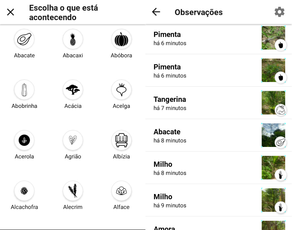
I asked Zé Ferreira, the very experienced agroforester, if a digital mapping tool could be useful for managing his land. His response was very positive, and he told how they have drawn many maps of his systems. But paper maps can’t be updated and the fast dynamics of agroforests require constant change.
Maps are especially instructive for volunteers and newcomers to an agroforest as they provide an overview of the system’s biodiversity, economic value and the network of relations between species.
It’s rarely worth pin-pointing every species in an agroforestry system, as species are usually organized in areas. After collecting data with the mobile app, we can use the desktop app to turn each observation into consortium lines or areas.The full potential of this technology is realized when we have the ability to share our experiences through the data we gather and maps we create. And we might be able to achieve that soon with Mapeo Web.
Try it out!
We’re rediscovering, from the few native cultures that resisted, practices that we (civilization) massacred and now need to learn in order to survive. Little credit is being given to Indigenous cultures. If permaculture and syntropic agriculture are less than a century old, truly permanent cultures have practiced forest agriculture for thousands of years.
As any technology, agroforestry won’t save the world, but it can certainly contribute to improving our slim chance of survival on this planet. Spreading knowledge and tools around it is fundamental for it to scale, giving it a chance to revert the damage being done by monoculture and pasture, especially in territories such as Brazil.
Mapeo is an amazing tool for mapping agroforestry data, and with some tweaking, also for displaying information on many different species and sharing knowledge through the web. There are still many improvements that could be made to Mapeo’s code in order to make it more appropriate for the job.
Interested? Try out the agroforestry mode by downloading the latest version of Mapeo and the latest version of the agroforestry preset (the .mapeosettings file). Now just load the config file into the mobile or the desktop app, and start mapping! If you need some help, check out the docs and don’t hesitate to contact us.
If you’re interested in improving tooling around mapping agroforestry systems, please get in touch at:
